Wicked Problem
Flood Management in Kamloops
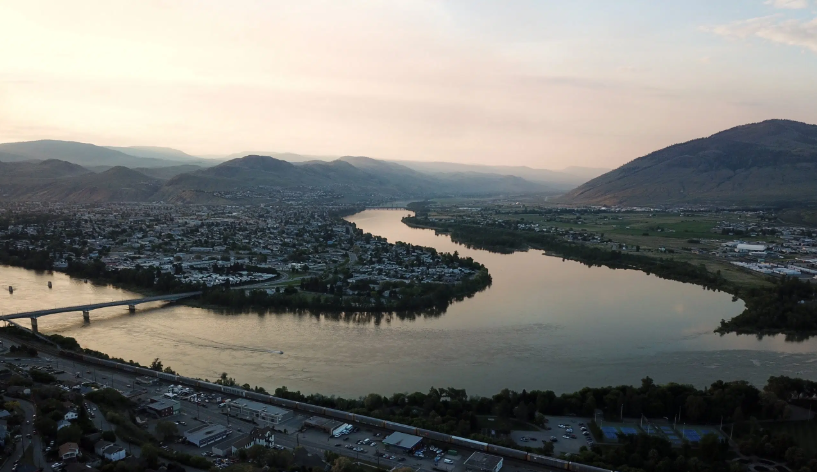
Kamloops exists within a floodplain, a landscape marked by water long before settlement. what are the implications today, and what risks remain despite our systems of protection?
Image source: https://www.radionl.com/2018/10/19/17266/
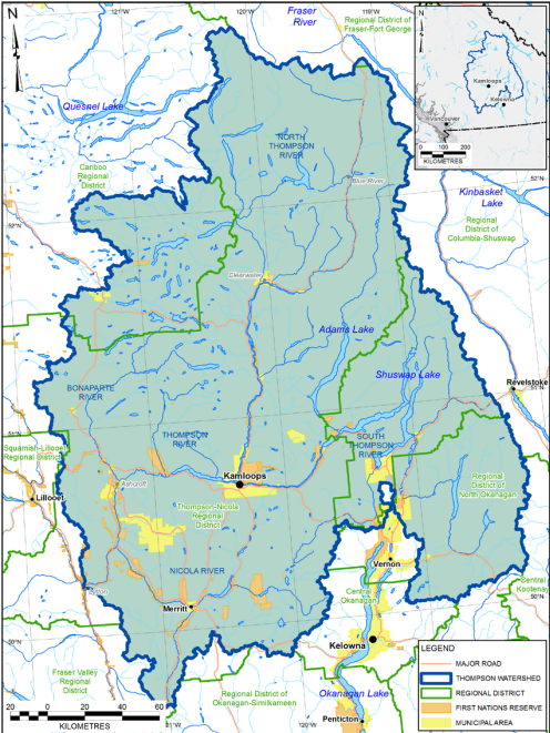
Thompson River Watershed
This is a Image of the Thompson River Watershed, where all water across south-central British Columbia eventually drains into the Thompson River system. The scale and behaviors of this system determines flow, velocity, and the potential for infrastructural damage. As climatic conditions shift, sudden change in runoff and river dynamics may occur, placing increasing pressure on flood-management systems and raising challenges for protecting both people and the environment.
Image source: https://www.fraserbasin.bc.ca/_Library/TR_Flood/twra_final_report.pdf
Why Does Flood Management Matter?
Flooding has shaped Kamloops since time immemorial, and the city’s position at the confluence of two rivers means that, as long as the water flows, it will continue to shape Kamloops future. As climate extremes intensify (Zielke & Daust, n.d., p. 1), reliance on aging dikes and outdated hazard maps fall short, leaving planners and communities without accurate data needed for effective flood management (FBC, 2020, pp. 13–15). Flood management matters because risk moves beyond the city limits of Kamloops. It requires shared responsibility, proactive planning, and adaptation across the entire Thompson River Basin.
Why is this problem Wicked?
Flood management in Kamloops is a wicked problem because it is shaped by overlapping systems. Aging dikes, reactive policies such as the DFA (BC, Financial Assistance in a Disaster 2025), unequal preparedness, and top-down governmental structures. Climate change and outdated hazard mapping create further uncertainty, and local interventions can pose downstream impacts and social inequalities (Parno, 2024, p. 11). These interconnections mean there is no single solution to this wicked problem.
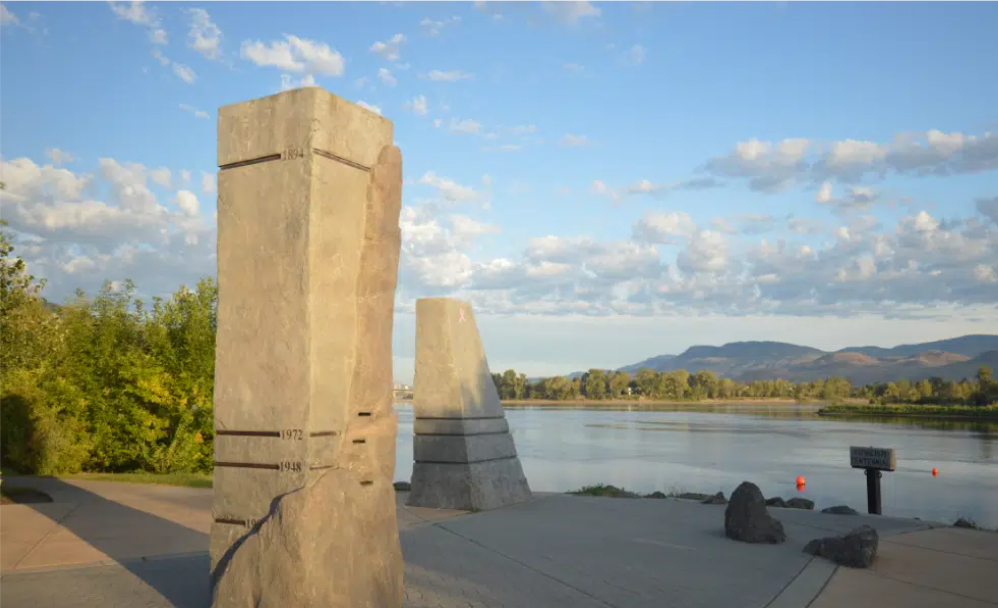
Past Flood Events in Kamloops, British Columbia
References
BC, E. M. (2025, October 27). Financial assistance in a disaster. Province of British Columbia. https://www2.gov.bc.ca/gov/content/safety/emergency-management/preparedbc/evacuation-recovery/disaster-financial-assistance
BC Ministry of Environment, Lands and Parks. (1999). Guidelines for management of flood protection works in British Columbia. Water Management Branch. https://www2.gov.bc.ca/assets/gov/environment/air-land-water/water/integrated-flood-hazard-mgmt/gd_mgt_fld_pro_bc.pdf
Breen, M. J., Kebede, A. S., & König, C. S. (2022). The Safe Development Paradox in flood risk management: A critical review. Sustainability, 14(24), 16955. https://doi.org/10.3390/su142416955
City of Kamloops. (2025, March 26). 2022 Kamloops Green Infrastructure Research Project Report. Issuu. https://issuu.com/city_of_kamloops/docs/2022_kamloops_green_infrastructure_research_projec
City of Kamloops. (n.d.). Flood preparedness and sandbagging instructions. City of Kamloops Emergency Program. Retrieved October 27, 2025, from https://www.kamloops.ca
Cozzani, V., Campedel, M., Renni, E., & Krausmann, E. (2010). Industrial accidents triggered by flood events: Analysis of past accidents. Journal of Hazardous Materials, 175(1–3), 501–509. https://doi.org/10.1016/j.jhazmat.2009.10.033
Fraser Basin Council. (2020). Thompson River watershed base level flood hazard mapping – Final report. BGC Engineering Inc. https://www.fraserbasin.bc.ca/
Fraser Basin Council. (2021). Thompson-Nicola flood hazard assessment. Thompson-Nicola Regional District. https://www.fraserbasin.bc.ca/_Library/TR_Flood/TNRD_Flood_Hazard_Assessment_2021_Final_Web.pdf
Fraser Basin Council. (2022). Thompson River watershed geohazard risk prioritization. Fraser Basin Council. file:///C:/Users/User1/OneDrive%20-%20Thompson%20Rivers%20University/Documents/Wicked%20Problem%20Project/Thompson%20River%20Watershed%20Geohazard%20Risk%20Prioritization.pdf
Government of British Columbia. (2022, March). BC good agricultural practices guidelines: Risk assessment for natural flood disaster events (Photo credit: Mike Boot). https://www2.gov.bc.ca
Parno, M. (2024). Flood mitigation in the Fraser Valley: An exploration of passive water storage on agricultural land. UBC Sustainability Scholars Program https://www.sustain.ubc.ca/sites/default/files/2024-028
Turner, R. J. W. (2008). GeoTour guide for Kamloops, British Columbia. Geological Survey of Canada. https://publications.gc.ca/site/eng/9.836648/publication.html
Zielke, K., & Daust, D. (n.d.). Kamloops case study. Government of British Columbia. https://www2.gov.bc.ca/assets/gov/environment/natural-resource-stewardship/nrs-climate-change/applied-science/4b_app_kamloops_case_study_august27final.pdf